
Land & Construction
Is Your Land Actually Build-Ready?
Owning land does not necessarily mean you are ready to build. Access, zoning, terrain, drainage, utilities, permits, and site costs all need to align.
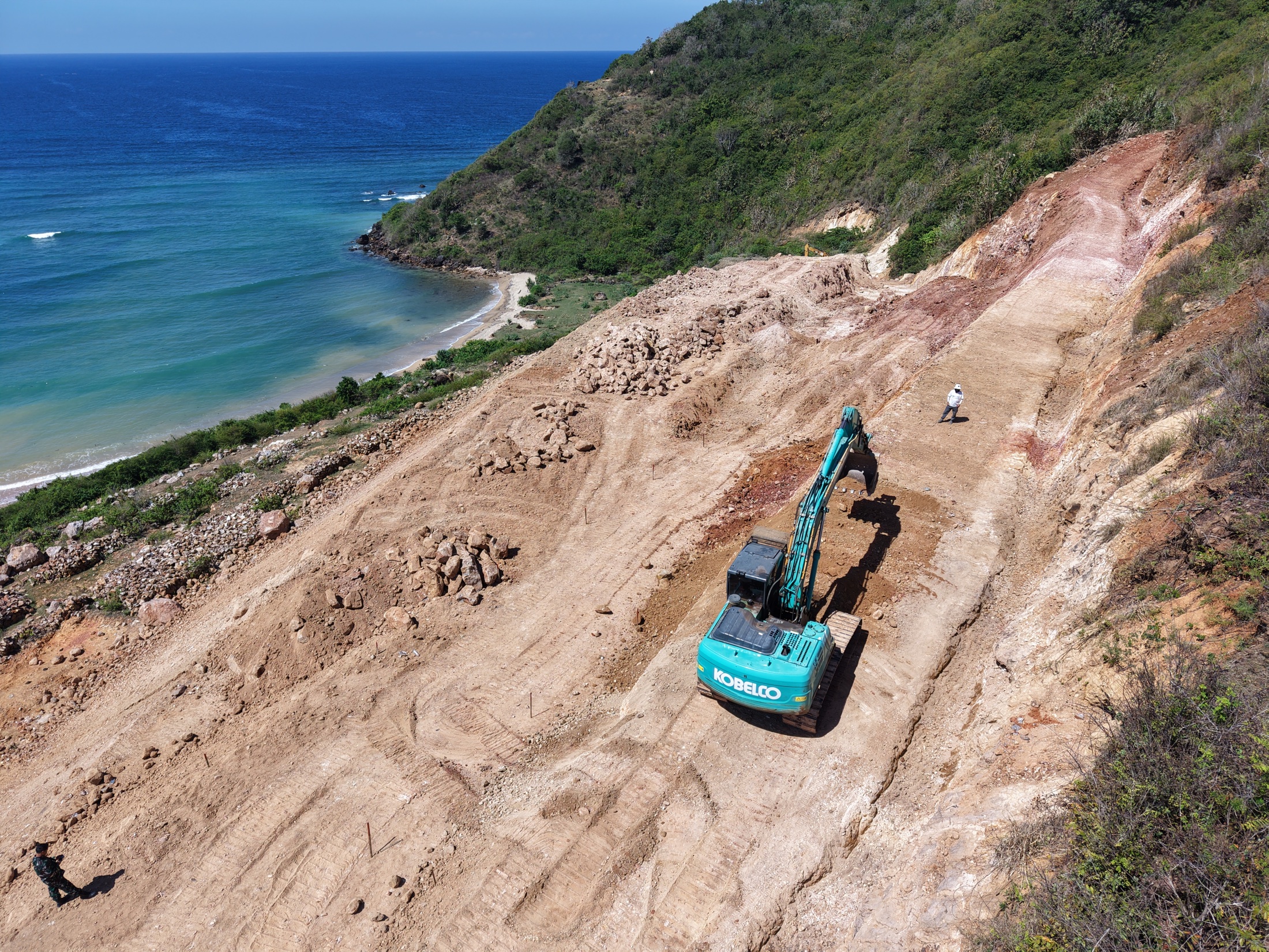
A land certificate tells you that a parcel exists and that certain rights are attached to it. It does not tell you whether a concrete truck can reach the site, whether the proposed villa matches the spatial plan, how rainwater will leave the property, or how much earth must be moved before the first foundation is poured.
This is the difference between owning land and owning land that is build-ready.
A site may look ideal in photographs and still require months of preparation, major infrastructure work, or a complete redesign. These issues do not necessarily make the land a bad investment. But they should be understood before committing to a design, construction price, or completion date.
Here is what we look at when assessing whether land in Lombok is genuinely ready for development.
1. Does the Intended Use Match the Spatial Plan?
The first question is not simply, “Can something be built here?” The more important question is: can the type of project you intend to operate be developed at this location?
A private residence, rental villa, restaurant, and boutique hotel may follow different spatial-planning and business-permitting pathways. The fact that neighbouring land has already been developed does not automatically confirm that your proposal will receive the same treatment.
Indonesia's OSS system includes the KKPR and RDTR spatial-planning process for checking whether a proposed activity conforms to the applicable plan. The exact route depends on the location, available spatial data, project structure, and intended use. The current official pathway can be reviewed through the OSS spatial-planning guidance.
Before design begins, confirm:
- The applicable land-use designation
- Whether the proposed building function is compatible
- Whether the intended commercial activity can be licensed
- Whether coastal, environmental, heritage, or infrastructure restrictions may apply
- Which local authority will review the application
A beautiful concept is not useful if it is designed for an activity the site cannot legally support.
2. Is the Entire Plot Actually Usable?
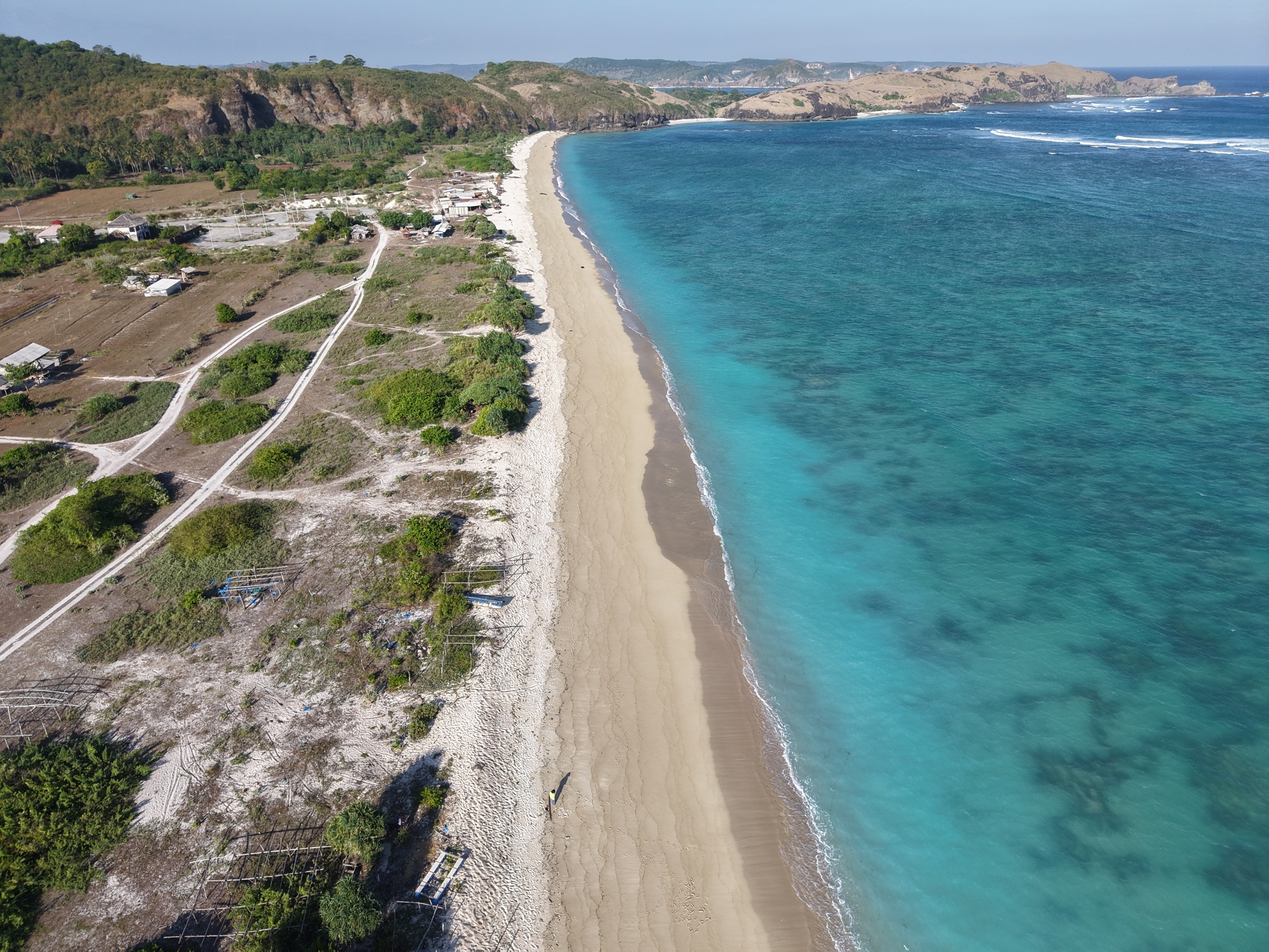
A 1,000 m² certificate does not always mean you have 1,000 m² available for buildings, pools, parking, access, drainage, and landscaping.
The usable development area can be reduced by:
- Required access and circulation
- Existing easements or informal paths
- Irregular boundaries
- Sharp changes in level
- Drainage channels
- Utility corridors
- Setback and planning requirements
- Areas that are technically difficult or uneconomical to build on
This is why the legal boundary should be compared with a current physical survey. A topographic survey is particularly important for sloped or coastal land. It allows the architect and engineers to understand the actual contours rather than designing from a flat certificate plan or satellite image.
The goal is to identify the site's realistic building envelope before too much time is spent on a concept that may not fit.
3. Can Construction Vehicles and Materials Reach the Site?
Road access for a finished villa is different from access during construction.
A small car or motorcycle may reach the land easily, while excavators, concrete trucks, steel deliveries, water tanks, and long construction vehicles cannot. Narrow corners, weak bridges, steep gradients, low cables, and privately controlled sections of road can all create problems.
If conventional delivery is impossible, materials may need to be transferred into smaller vehicles or carried manually. That affects labour requirements, material waste, equipment availability, construction duration, and total project cost.
Access should also be legally secure. A road that crosses another person's land based only on a verbal understanding can become a serious risk once construction activity increases.
Before budgeting the project, trace the complete route from the nearest main road to the building area—not just to the boundary of the property.
4. How Much Site Preparation Is Required?
On many Lombok sites, construction begins long before the foundation.
The land may first require:
- Vegetation clearing
- Excavation and cut-and-fill work
- Temporary construction access
- Slope stabilisation
- Retaining structures
- Drainage preparation
- Soil replacement or compaction
- Storage and working areas for construction
These are often called enabling or preliminary works. They may not appear in the architectural images, but they can have a substantial effect on cost and schedule.
Sloped land is not automatically a problem. In fact, it can create exceptional views and architecture. The key is to design with the contours rather than assuming the site can simply be made flat.
5. What Is Happening Below the Surface?
The ground can appear solid while having weak, filled, eroded, or inconsistent layers below it. Soil conditions influence the foundation type, structural design, retaining walls, pool construction, settlement risk, drainage behaviour, and earthquake performance.
The official SIMBG guidance notes that soil investigation may be required for buildings above two storeys or buildings located on unstable ground. Requirements depend on the proposed building and site conditions, so the structural engineer should determine the appropriate investigation.
This is especially relevant for filled land, steep slopes, sites near cliffs, areas with visible erosion, former agricultural or excavated land, and properties where neighbouring structures show cracking or settlement.
A soil investigation adds cost at the beginning, but it can prevent much more expensive structural changes later.
6. Where Will Water Go During Heavy Rain?
Drainage is one of the least glamorous and most important parts of site planning.
It is easy to evaluate land during dry weather and miss what happens during Lombok's rainy season. Water may enter from higher neighbouring land, collect in low areas, cross an existing natural route, or flow toward a future foundation.
A proper assessment should consider:
- The direction of surface runoff
- Water entering from outside the property
- Existing natural drainage routes
- Roof and hardscape runoff
- Pool overflow and road drainage
- Safe discharge points
- Erosion at the lower boundary
Drainage should be designed as part of the architecture and landscape—not added after the villa is already built.
7. Are Power, Water, Waste, and Connectivity Realistically Available?
“Utilities nearby” is not the same as utilities being ready for your project.
Before finalising the design and budget, confirm the location and capacity of the nearest electricity connection, the proposed water source, dry-season availability, water storage and treatment, wastewater strategy, internet connectivity, and access for service vehicles.
Water requires particular attention. A supply that is sufficient for a small house may not support multiple rental units, pools, landscaping, staff use, and peak guest demand.
The design must respond to the capacity that can realistically be provided—not an assumption made during the first site visit.
8. Has the Design Responded to the Actual Site?
A build-ready project is not created by forcing a generic villa plan onto the land.
The design should respond to sun orientation, prevailing wind, views and privacy, existing vegetation, topography, road position, drainage, soil conditions, material delivery, and future maintenance.
This is why choosing a villa design before understanding the land often leads to redesign and additional cost. The strongest projects begin with the site. The land's constraints become part of the architecture instead of being treated as problems to solve later.
9. Is the Budget Based on the Whole Project?
A construction price per square metre normally describes the building itself. It may not include everything required to make the site functional.
Depending on the property, additional costs may include surveys, engineering, permit preparation, earthworks, access improvements, retaining walls, drainage, utility connections, landscaping, external works, professional supervision, and contingency.
Two villas with identical floor areas can have very different total development costs because of their sites.
Before comparing contractor quotations, confirm what is included, excluded, provisional, or still unknown. A low building price can be misleading if the difficult site work has not yet been assessed.
10. Is the Project Ready for the Approval Process?
Indonesia uses PBG—Persetujuan Bangunan Gedung—as the building approval framework. The official SIMBG portal explains that PBG confirms the proposed technical plan meets applicable standards before entering construction. After completion, SLF—Sertifikat Laik Fungsi—confirms that the building is suitable for use.
The process is administered through SIMBG and handled by the relevant local authorities according to the building's location. Official guidance also identifies spatial-use and environmental documentation as prerequisites that may be required before a PBG application. Current information is available through the Ministry of Public Works' SIMBG portal.
Permit readiness means more than completing an application form. The land information, intended use, architectural drawings, engineering documents, and supporting approvals must be consistent with one another.
Requirements can vary by project and local authority, so they should be confirmed before construction commitments are made.
A Simple Build-Readiness Test
| Status | What It Means |
|---|---|
| Green | Boundaries, access, intended use, survey, utilities, drainage strategy, concept, preliminary budget, and approval pathway are understood. |
| Amber | The land may be viable, but surveys, access agreements, soil information, utility checks, or planning confirmation are still incomplete. |
| Red | The proposed use conflicts with planning information, access is insecure, the usable area is unclear, or major site risks have not been assessed. |
Most land begins in the amber category. The objective is not to find a site with no challenges. It is to identify those challenges early enough to make informed design and investment decisions.
What to Prepare for an Initial Site Assessment
- A location pin
- Land certificate or available ownership documents
- Survey or boundary information
- Total land area
- Recent site photographs and drone images
- Road-access photographs
- A short description of the intended project
- Target number of bedrooms or units
- Indicative budget and preferred timeline
With this information, a development team can identify the immediate questions and advise which technical checks should come next.
Build-Ready Does Not Mean Problem-Free
Very few sites are completely ready from day one.
Build-ready means the important constraints have been identified, the development concept responds to them, and the cost and approval implications are understood before construction begins.
That preparation protects more than the budget. It creates a clearer design process, a more realistic schedule, and a finished property that works with its location.
At Sanbada Development, we assess land from the perspective of the complete project—from spatial planning and site access to design, construction, and future operation.
If you have a plot in Lombok and want to understand what it will realistically take to develop, contact us or send the location, land size, and available site information via WhatsApp. We will help you identify the practical next step.
This article provides general project-planning information and is not legal, engineering, or permit advice. Site-specific requirements should be confirmed with qualified professionals and the relevant local authorities.